You plan to move to the Philippines? Wollen Sie auf den Philippinen leben?

There are REALLY TONS of websites telling us how, why, maybe why not and when you'll be able to move to the Philippines. I only love to tell and explain some things "between the lines". Enjoy reading, be informed, have fun and be entertained too!

Ja, es gibt tonnenweise Webseiten, die Ihnen sagen wie, warum, vielleicht warum nicht und wann Sie am besten auf die Philippinen auswandern könnten. Ich möchte Ihnen in Zukunft "zwischen den Zeilen" einige zusätzlichen Dinge berichten und erzählen. Viel Spass beim Lesen und Gute Unterhaltung!


Visitors of germanexpatinthephilippines/Besucher dieser Webseite.Ich liebe meine Flaggensammlung!

free counters
Showing posts with label Typhoon. Show all posts

Saturday, October 22, 2022

Agricultural damage of Typhoons ‘Maymay’, ‘Neneng’ reaches P583.45M — DA

by Jel Santos, MB

The agricultural damage caused by Typhoons “Maymay” and “Neneng” has reached P583.45 million, the Department of Agriculture (DA) bared on Friday, Oct. 21.

FLOOD caused by severe tropical storm ‘Neneng’ shuts down the Claveria Detour Bridge on the Manila North Road in Claveria, Cagayan on Sunday, Oct. 16. (DPWH/Alain Garret Badiang)

Per the DA’s Bulletin No. 5, the areas covered in the estimate are Cordillera Administrative Region (CAR), Ilocos Region, and Cagayan Valley, devastating 21,986 hectares of agricultural areas. 

Around 21,324 farmers and fishers have been affected by Maymay and Neneng.

The agriculture department pegged the production loss at 36,872 metric tons.

Rice, corn, high-value crops, livestock and poultry, and fisheries are among the commodities affected, the DA said.

The agriculture department explained that the values of damage and losses for Maymay and Neneng have been combined as the “two tropical cyclones occurred in a span of one week and affected the same agricultural areas in CAR, Ilocos Region and Cagayan Valley.” 

According to the DA, it is constantly coordinating with concerned national government agencies, local government units, and other disaster risk reduction and management-related offices on the impact of tropical cyclones, as well as available resources for interventions and assistance.

Mobile Kadiwa centers are being prepared for deployment in areas impacted by Maymay and Neneng in order to stabilize agri-fishery commodity prices and supply, it added.

Here is the list of aid made available by the DA for affected farmers and fishers:

  • Rice, corn and assorted vegetable seeds
  • Drugs and biologics for livestock and poultry
  • Fingerlings and assistance to affected fisherfolk from Bureau of Fisheries and Aquatic Resources (BFAR)
  • Survival and Recovery (SURE) Loan Program from the Agricultural Credit Policy Council (ACPC) with loanable amount of up to P25,000 payable in three years at zero interest
  • Quick Response Fund (QRF) for the rehabilitation of affected areas

Wednesday, April 13, 2022

MB Daily News Update: ‘Basyang’ out, ‘Agaton’ stays


Published April 13, 2022, 7:30 AM

Typhoon Basyang had a brief foray into the Philippine area of responsibility (PAR) before veering away, and will no longer affect the country’s weather condition. But tropical depression Agaton remained almost stationary over Llorente town in Eastern Samar.

The wrath of “Agaton” continued to be felt as authorities reported the increase of the number of fatalities to 33 on Tuesday night, April 12, 2022. Reports on damage caused to infrastructure and agriculture are also expected to be released on Wednesday.

Thursday, December 16, 2021

Typhoon 'Odette' maintains strength, now heading towards eastern part of Caraga


(Photo from PAGASA / MANILA BULLETIN)

Published December 16, 2021, 3:01 AM


by Dhel Nazario, Manila Bulletin


Typhoon ‘Odette’ has maintained its strength and is headed for the waters off to the east of Caraga region, the Philippine Atmospheric, Geophysical and Astronomical Services Administration (PAGASA) said on Thursday, Dec. 16.


As of 1:00 a.m. PAGASA said that the center of typhoon Odette was last seen 410 kilometers (km) East of Surigao City, Surigao del Norte. It is expected to make landfall in the vicinity of Dinagat Islands, Siargao-Bucas Grande Islands, or the northern portion of Surigao del Sur on Thursday afternoon.


Odette maintained its strength packing maximum sustained winds of 140 kph near the center and gustiness of up to 170 kph. Signal No. 3 was raised in the areas of Southern Leyte, Dinagat Islands, Surigao del Norte, the northern portion of Agusan del Norte, and the northern portion of Surigao del Sur.


Areas under Signal No. 2 include the southern portion of Masbate, the central and southern portions of Eastern Samar, the central and southern portions of Samar, Biliran, Leyte, Cebu, Bohol, Negros Oriental, Siquijor, Negros Occidental, Guimaras, Iloilo, Capiz, and the southern portion of Antique, the rest of Surigao del Sur, the rest of Agusan del Norte, Agusan del Sur, the northern portion of Bukidnon, Misamis Oriental, Camiguin, the extreme northern portion of Misamis Occidental, and the extreme northern portion of Zamboanga del Norte.


Meanwhile, the areas placed under Signal No. 1 were Catanduanes, Camarines Sur, Albay, Sorsogon, the rest of Masbate including Ticao and Burias Islands, Marinduque, Romblon, the southern portion of Quezon, the southern portion of Batangas, Oriental Mindoro, Occidental Mindoro, and the northern and central portions of Palawan including Calamian, Cagayancillo and Cuyo Islands, Northern Samar, the rest of Eastern Samar, the rest of Samar, Aklan, Antique, Capiz, and the rest of Iloilo, the northern portion of Davao Oriental, the northern portion of Davao de Oro, the northern portion of Davao del Norte, the rest of Misamis Occidental, the central portion of Bukidnon, the northern portion of Lanao del Norte, the northern portion of Lanao del Sur, the northern portion of Zamboanga del Norte, and the northern portion of Zamboanga del Sur.


Areas under Signal No. 3 are expected to experience “destructive typhoon-force winds” within 18 hours while “damaging gale-to storm-force” winds in areas under Signal No. 2 are expected within 24 hours and strong winds are likely to prevail within 36 hours in areas under Signal No. 1.


Heavy rains expected


Starting Thursday evening, (Dec. 16) heavy to intense with at times torrential rains may be experienced over Caraga, Misamis Oriental, Camiguin, Southern Leyte, and Bohol. Moderate to heavy with at times intense rains over Leyte, the southern portion of Eastern Samar, Leyte, Cebu, Siquijor, Negros Oriental, Zamboanga del Norte, Lanao del Sur, and the rest of Northern Mindanao.


Light to moderate with at times heavy rains over Bicol Region, Davao Oriental, Davao de Oro, Davao del Norte, and the rest of Visayas, Zamboanga Peninsula, and mainland Bangsamoro.


From Thursday evening (Dec. 16) through Friday evening (Dec. 17) heavy to intense with at times torrential rains may prevail over Central Visayas, Western Visayas, and Palawan including Calamian Islands, Cuyo, and Cagayancillo Islands.


Moderate to heavy with at times intense rains over Bicol Region, Zamboanga Peninsula, Occidental Mindoro, Oriental Mindoro, Romblon, Lanao del Norte, Lanao del Sur, and the rest of Visayas. Light to moderate with at times heavy rains over Caraga, Quezon, the southern portion of Aurora, and the rest of Northern Mindanao and MIMAROPA.


Beginning Friday evening (Dec. 17) through Saturday evening (Dec. 18), heavy to intense with at times torrential rains over the central portion of Palawan including Kalayaan Islands is possible. Moderate to heavy rains over Aurora, Quezon, and the rest of Palawan may also be experienced, said PAGASA.


“Under these conditions, scattered to widespread flooding (including flash floods) and rain-induced landslides are expected especially in areas that are highly or very highly susceptible to these hazard as identified in hazard maps, and in localities with significant antecedent rainfall,” it added.


A moderate to high risk of storm surge of up to 3.0 meters in height which may cause flooding in the low-lying coastal localities of Central Visayas, Iloilo, Guimaras, Negros Occidental, Eastern Samar, Southern Leyte, Dinagat Islands, Surigao del Norte, Surigao del Sur, and several localities in the northern portion of Palawan including Calamian, Cuyo and Cagayancillo Islands, Antique, Camiguin, Leyte, Agusan del Norte, and Davao Oriental is possible.


Typhoon Odette is likely to move generally westward after its expected landfall and cross several provinces in Central and Western Visayas regions before emerging over the Sulu Sea on Friday morning (Dec 17).


After passing near or in the vicinity of either Cuyo or Cagayancillo archipelago, this tropical cyclone is likely to cross the northern or central portion of Palawann Friday afternoon or evening (Dec.17) before emerging over the West Philippine Sea.


PAGASA said that further intensification is expected from Thursday (Dec. 16) typhoon crosses the Philippine Sea and may reach a peak intensity of 155 kph prior to its landfall.


Odette may slightly weekean, according to PAGASA as it crosses northeastern Mindanao, Visayas, and Palawan, but it is likely to remain within the typhoon category. Re-intensification is likely once it emerges over the West Philippine Sea. However, weakening may ensue beginning Sunday (Dec. 19) as the typhoon becomes exposed to increasing vertical wind shear and the surge of the northeast monsoon.

Tuesday, October 30, 2018

Typhoon prompts Philippine evacuation ...

... in storm-prone provinces

Filipino workers take down a large billboard sign in anticipation of strong winds brought by an upcoming typhoon in Bacoor city, Cavite province, Philippines, on Monday. (EPA photo)
MANILA: Philippine authorities started to move people to safer grounds as Typhoon Yutu approaches, tracking a path similar to last month’s storm that devastated rice-producing provinces in the main island of Luzon.
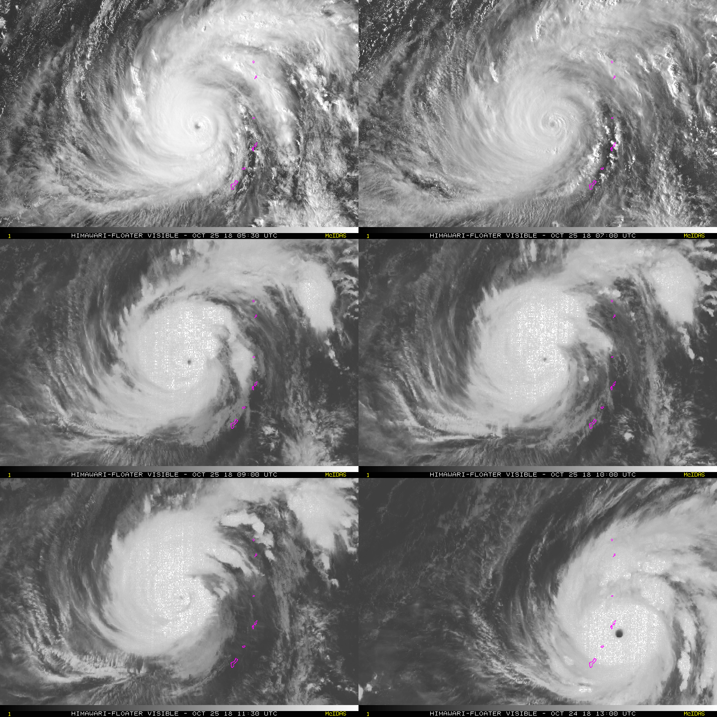
Yutu, which last week became the strongest storm since 1950 to hit the US territories in the Northern Mariana Islands, is now the equivalent of a Category 2 storm on the US Saffir-Simpson scale. Its maximum winds have slowed to 167 kilometres per hour, according to the latest Joint Typhoon Warning Center forecast.
The typhoon is forecast to make landfall on Tuesday either in the province of Isabela or Aurora in northern Philippines, according to the local weather bureau. Mangkhut, which killed more than 120 people in the Philippines and damaged about 26.7 billion pesos ($498 million) of the nation’s farm output, slammed into Cagayan province, also in north Luzon, in September.
Storm signal No. 3 was raised in the provinces of Isabela, Quirino and Aurora. Under the third-highest alert, rice and corn crops may suffer heavy losses and widespread disruption of power and communication lines may happen, according to the Philippine weather bureau.
More than two dozen areas including the capital region of Metro Manila are under lower alert levels. About 20 cyclones pass through disaster-prone Philippines each year. In 2013, Super Typhoon Haiyan killed more than 6,300 people in the Southeast Asian nation.
As many as 12 million people in 290 cities and towns in Luzon are along the storm’s path, Edgar Posadas, spokesman for the Philippine disaster-monitoring agency, said at a televised briefing.
Cebu Air Inc. canceled several local flights ahead of the Halloween break. Yutu, named Rosita in the Philippines, was about 355 kilometres from Luzon’s east coast on Monday afternoon.
Last month, Mangkhut hit the Philippines main island before striking Hong Kong. At their peak, both Mangkhut and Yutu had winds of 180 miles per hour, making them the strongest in the world this year.
“Manila will get a little bit of rain but the worst of it is well to the north,” said Jason Nicholls, a meteorologist with AccuWeather Inc. in State College, Pennsylvania.
The mountains of Luzon will tear at Yutu’s structure and significantly weaken the storm before it emerges into the South China Sea Wednesday, Nicholls said.
Yutu is forecast to drift north, possibly bringing rain to China’s southeast coast in the coming days.

Saturday, October 27, 2018

'YUTU' weakens ...

Gillan Ropero, ABS-CBN News


MANILA - Typhoon Yutu weakened on Thursday evening as it continues to approach the Philippine area of responsibility.
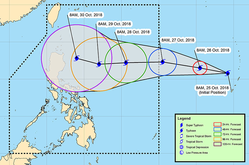
PAGASA weather forecaster Gener Quitlong said the typhoon was last spotted 2,230 kilometers east of Central Luzon (outside PAR) as of 8 p.m.
It is now packing maximum sustained winds of 185 km per hour from 210 kph at 4 p.m, and gusts of up to 225 kph from 260 kph.
The typhoon, which will be named Rosita, is forecast to enter PAR by Saturday morning if it continues to move west at 15 kph.
According to ABS-CBN resident meteorologist Nilo Millanes, Yutu is considered as a "violent typhoon" by the Japan Meteorological Agency (JMA).
A violent typhoon is the highest category on the agency’s scale, with its strength of 215 kph near the center and gustiness of 305 kph 
The Joint Typhoon Warning Center (JTWC), meanwhile, categorized Yutu as a supertyphoon, with a strength of 270 kph and gusts reaching up to 325 kph.
Track of Typhoon Yutu. PAGASA
Yutu slammed into US Western Pacific territories on Wednesday. It was the second major typhoon to hit the islands after Mangkhut struck in September, bringing strong winds and rains that caused damage in Hong Kong and Macau and triggered landslides that killed dozens in the Philippines.
Millanes said the probability of the typhoon to make landfall in Northern Cagayan, Philippines is low as of posting time due to the wide spread in the forecast tracks after the 72-hour forecast time.

Sunday, September 16, 2018

'Ompong' strongest storm this year

By: (philstar.com) - September 16, 2018 - 7:35am

MANILA, Philippines — Typhoon Ompong barrels towards densely populated Hong Kong and southern China, hours after it left the Philippine area of responsibility at 9 p.m. on Saturday, PAGASA said, as it warned of monsoon rains.
In its 23rd and final severe weather bulletin on "Ompong" at 5 a.m. Sunday, PAGASA said the eye of the typhoon, the strongest to hit the country this year, was located at 570 km west of Basco, Batanes at 4 a.m. today.
"Ompong" was packing maximum sustained winds of 145 kph near the center and gustiness of up to 180 kph. It moves at a west-northwest direction at 25 kph.
All tropical cyclone warning signals were lifted by PAGASA.
PAGASA weather forecaster Ariel Rojas said Saturday that even though the storm had passed the Philippines, it would continue to bring heavy rain in the country possibly causing more floods and landslides until Monday.
On Sunday, PAGASA said the southwest monsoon or "habagat" enhanced by "Ompong" would bring occasional gusty winds and scattered light to moderate to at times heavy rains over Western Visayas, Mimaropa, Ilocos Region, Batangas, Bataan and Zambales. 
Fisherfolk and those with small seacrafts were also advised not to venture out over the northern and western seaboards of Luzon.

At least 8 dead

"Ompong" has smashed through the Philippines, as the biggest storm to hit the region this year claimed the lives of its first victims and forced tens of thousands to flee their homes. 
Roughly four million people—a quarter of whom live on a few dollars a day—were in the path of destruction that the storm slashed through the northern tip of Luzon island on Saturday, leaving at least eight dead. 
"As we go forward, this number will go higher," Ricardo Jalad, head of the Office of Civil Defense, told reporters Saturday, referring to the death toll. 
The dead were six people killed in landslides, a girl who drowned and a security guard crushed by a falling wall. In addition to the eight killed in the Philippines, a woman was swept out to sea in Taiwan.
 As the powerful storm left the Philippines, authorities began sending search teams to remote areas hit by communication and power outages.
In the northern town of Baggao, the storm had collapsed houses, torn off roofs and downed power lines. Shell-shocked villagers could be seen picking through the debris from their homes.
But the full extent of the storm's destruction was only beginning to be known, with reports of dozens of rain-soaked hillsides collapsing, torrents of out-of-control floodwaters and people being rescued from inundated homes.
More than 105,000 people fled their homes in the largely rural agricultural region, which is one of the nation's top producers of corn and rice. 
An average of 20 typhoons and storms lash the Philippines each year, killing hundreds of people and leaving millions in near-perpetual poverty.


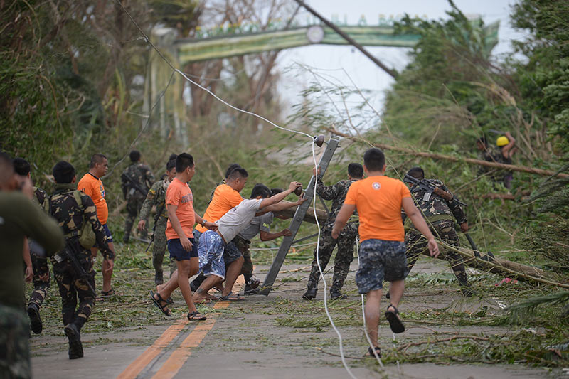
Rescue workers clear a road of debris and toppled electric posts caused by strong winds due to Typhoon Ompong as they try to reach Baggao town in Cagayan province, north of Manila September 15, 2018.
Ted Aljibe/AFP

'End of the world'

"Among all the typhoons this year, this one (Mangkhut) is the strongest," Japan Meteorological Agency forecaster Hiroshi Ishihara told AFP on Friday.
"This is a violent typhoon. It has the strongest sustained wind (among the typhoons of this year)."
Survivors were traumatized by the confrontation with the monster storm.
"It felt like the end of the world... that was stronger than Lawin", said Bebeth Saquing, 64, using the local name for Super Typhoon Haima, which was one of the most powerful storms of 2016.
"I did not sleep," she told AFP by phone from her home, which stood up to "Ompong's" pounding. 
As the storm is on pace to hit China's southern coast on Sunday, Cathay Pacific warned travelers that it expected more than 400 flight cancellations over the next three days.
Philippine government forecaster Ariel Rojas said that, even though the storm had passed the Philippines, it would continue to bring heavy rain in the country, possibly causing more floods and landslides until Monday.
But the storm was unlikely to get any stronger, Rojas said.
"It could likely maintain its current intensity or even weaken," he told AFP.
The Hong Kong government said "Mangkhut" would pose "a severe threat to the region." Many residents in the city and neighboring Macau stocked up on food and supplies.
Volunteers also helped residents of low-lying Hong Kong fishing village Tai O hoist their furniture and appliances to higher ground.
The president of Taiwan, Tsai Ing-wen, told citizens to be ready as powerful waves pounded the shore. 
"The typhoon is powerful and even (if) it's not expected to make a landfall in Taiwan, we should be well prepared and not... take it lightly," she wrote on Facebook.
 — with Agence France-Presse

Friday, December 22, 2017

'Vinta" moves over Davao Region

Signal No.2 in 17 areas as 'Vinta' moves over Davao Region

 6  93 googleplus0  0 
Sea travel remains risky over the seaboards of areas under Tropical Cyclone Warning Signal, Pagasa said. Aldo Nelbert Banaynal, file
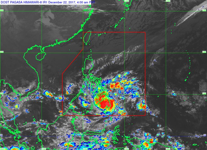
MANILA, Philippines — Storm Warning Signal No. 2 was up in 17 areas in the Visayas and Mindanao on Friday morning as Severe Tropical Storm Vinta moved west over Compostela Valley.
 
As of 7 a.m., Vinta was in the vicinity of Laak, a farming town in Compostela Valley and was moving west at 20 kilometers per hour, Pagasa said.
 
Vinta has maximum sustained winds of 90 kph near the center and gustiness of up to 125 kph, Pagasa said in an earlier Severe Weather Bulletin.
 
 
Cyclones with sustained winds of 89–117 kph are classified as severe tropical storms.
 
Vinta is expected to be 145 km west southwest of Dipolog City, Zamboanga del Norter by Saturday morning.
 
Tropical Cyclone Warning Signal No. 2 is up in the following areas:
 
Visayas
 
Siquijor
Southern Negros Oriental
 
Mindanao
 
Surigao del Norte including Siargao Islands
Surigao del Sur
Agusan del Norte
Agusan del Sur
Northern Davao Oriental
Compostela Valley
Davao del Norte
Camiguin
Bukidnon
Misamis Oriental
Lanao del Norte
Lanao del Sur
Misamis Occidental
Eastern Zamboanga del Norte
Eastern Zamboanga del Sur  
 
TWCS No. 1 has been raised over the following areas:
 
Visayas
 
Southern Leyte
Southern portion of Leyte
Bohol
Southern Cebu
Rest of Negros Oriental
Southern Negros Occidental
Mindanao
Dinagat Island
Rest of Davao Oriental
Davao del Sur
North Cotabato
Maguindanao
Rest of Zamboanga del Norte
Rest of Zamboanga del Sur
Zamboanga Sibugay

Tuesday, December 19, 2017

How you can help communities affected by 'Urduja'

By Patricia Lourdes Viray (philstar.com) 

 2  2 googleplus0  0 
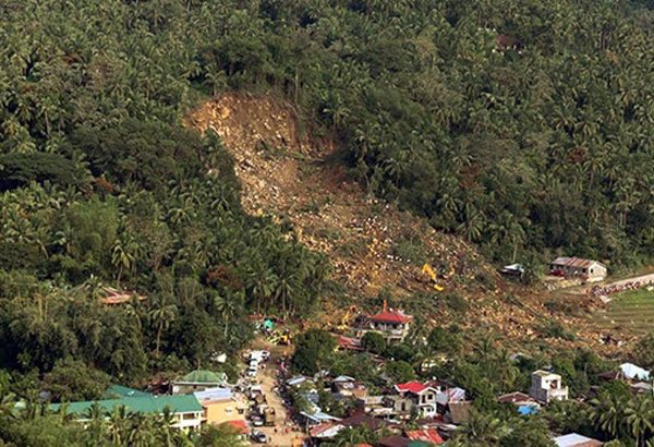
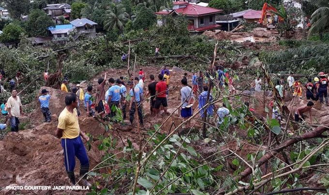
In this Dec. 17, 2017 photo provided by Philippine National Police Region 8, rescuers and police try to clear an area from boulders after Tropical Storm Kai-Tak hit the island province of Biliran, central Philippines. A slow-moving storm has left dozens of people dead and several others missing mostly due to landslides and floods and stranded thousands of holiday travelers in the central Philippines, officials said. Philippine National Police Region 8 via AP
MANILA, Philippines — Tropical storm Urduja (international name Kai-Tak) devastated Eastern Visayas when it struck the region last weekend, triggering landslides and killing at least 40 persons.
Casualties were reported in Biliran, Eastern and Samar. The province of Biliran and local governments of Kananga, Tanauan, Carigara, Ormoc and Tacloban in Leyte have been placed under a state of calamity. That gives them access to emergency funds for disaster relief and puts price freezes on basic goods.

Biliran Gov. Gerardo Espina said that communities in the province are running out of fuel and water as the storm damaged many vital bridges, preventing delivery of supplies.
–– ADVERTISEMENT ––

The Philippine Navy is set to utilize its newest and largest ships to deliver relief goods and basic services, as well as carry out humanitarian assistance and response operations in affected families and communities.
Those who would like to help families affected by the typhoon may donate through the Department of Social Welfare and Development.
Homepage ( Article MRec ), pagematch: 1, sectionmatch: 1
Dollar Savings Account
Account Name: DSWD FOREIGN DONATION
Account Number: 3124-0055-81
Swift Code: TLBPPHMMXXX
Bank Address: Land Bank of the Philippines, Batasan Branch, Constitution Hills, Quezon City
Peso Savings Account
Account Name: DSWD DONATION FUND
Account Number: 3122-1011-84
Bank Address: Land Bank of the Philippines, Batasan Branch, Constitution Hills, Quezon City
Some netizens have also started initiatives to help families and communities affected by the typhoon.

The DSWD is currently conducting relief operations to respond to the needs of those who were affected by Urduja. Teams will be deployed to different provinces including Leyte, Biliran, Eastern Samar, Samar and Northern Samar.