
PAGASA
Severe Tropical Storm Francisco (international name: Mekkhala) has exited the Philippine Area of Responsibility (PAR), while Tropical Storm Gardo (international name: Higos) entered the country’s monitoring area, the Philippine Atmospheric, Geophysical and Astronomical Services Administration (PAGASA) said on Thursday, June 25.
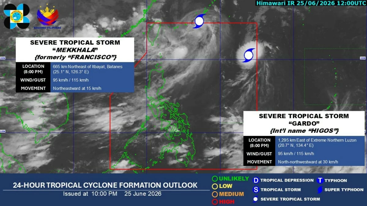
In its 8 p.m. bulletin, PAGASA said Francisco was last located 665 kilometers northeast of Itbayat, Batanes.
All tropical cyclone wind signals associated with the storm have been lifted.
Meanwhile, Severe Tropical Storm Gardo entered the PAR on Thursday afternoon and was estimated at 1,295 kilometers east of extreme Northern Luzon.
The storm was packing maximum sustained winds of 85 kilometers per hour (kph) near the center, gusts of up to 105 kph, and was moving northwestward at 45 kph.
PAGASA said Gardo is expected to remain far from the Philippine landmass throughout the forecast period.
“It is forecast to move north-northwestward to northward until it exits the PAR by Friday morning or afternoon (June 26),” the agency said.
Once outside the PAR, Gardo is expected to turn generally northeastward toward southern Japan.
It is forecast to remain a tropical storm, although slight intensification into a severe tropical storm is not ruled out.
Over the next 24 hours, PAGASA said the trough or extension of Francisco may continue to bring scattered rains and thunderstorms over Batanes and the Babuyan Islands.
The southwest monsoon or “habagat” may also bring occasional moderate to heavy rains over Zambales, Bataan, and Occidental Mindoro.
Scattered habagat rains and thunderstorms are likewise expected over Metro Manila, Ilocos Region, Cordillera Administrative Region, Calabarzon, Western Visayas, the rest of Cagayan Valley, the rest of Central Luzon, and the rest of Mimaropa.
The rest of the country will experience partly cloudy to cloudy skies with isolated rain showers or thunderstorms.
No comments:
Post a Comment