
At A Glance
- PAGASA weather specialist Aldczar Aurelio said the LPA is expected to pass through the Southern Luzon-Visayas area on Tuesday, June 30, before emerging over the West Philippine Sea by Wednesday, July 1.
- If it develops into a storm within the Philippine area of responsibility, it will be given the name "Henry."
PAGASA
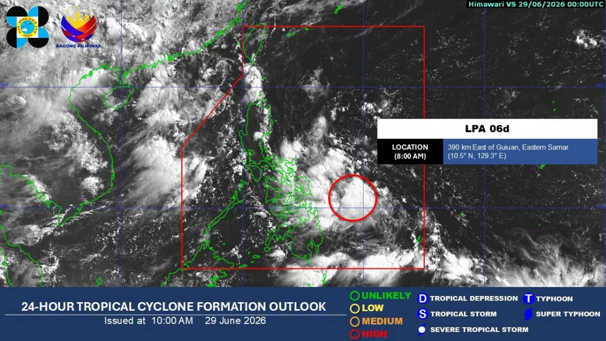
A low-pressure area (LPA) east of Guiuan, Eastern Samar has a high chance of developing into a tropical cyclone within the next 24 hours, the Philippine Atmospheric, Geophysical and Astronomical Services Administration (PAGASA) said on Monday, June 29.
As of 8 a.m., the LPA was located 390 kilometers east of Guiuan, Eastern Samar.
PAGASA weather specialist Aldczar Aurelio said the weather disturbance is expected to pass through the Southern Luzon-Visayas area on Tuesday, June 30, before emerging over the West Philippine Sea by Wednesday, July 1.
Once over the West Philippine Sea, the LPA will have a high chance of intensifying into a tropical cyclone, Aurelio said.
If it develops into a storm within the Philippine area of responsibility, it will be given the name “Henry.”
The LPA will bring cloudy skies with scattered rains and thunderstorms over the Visayas, Bicol Region, Caraga, Quezon, Oriental Mindoro, Marinduque, and Romblon.
Meanwhile, Aurelio said the southwest monsoon, locally known as “habagat,” has weakened as of Monday and is currently affecting only the western section of Southern Luzon.
However, it is expected to affect parts of Mindanao again on Tuesday as the potential cyclone enhances the habagat.
Metro Manila and the rest of the country will experience partly cloudy to cloudy skies with isolated rain showers or thunderstorms, PAGASA said.
Aurelio advised the public to stay alert for possible flooding and landslides in areas affected by prolonged or heavy rainfall.