
Rest of the country may experience localized thunderstorms
At A Glance
- In its weekly weather outlook, PAGASA said scattered rains and thunderstorms may affect Western Visayas, Negros Island Region, Zamboanga Peninsula, Palawan, and Occidental Mindoro until Tuesday, Sept. 22
- The habagat may weaken again starting Wednesday, Sept. 23
- The rest of the country may experience localized thunderstorms, mostly in the afternoon or evening
PAGASA
The southwest monsoon or “habagat” is expected to affect parts of the country anew starting this Saturday, Sept. 19, as the low-pressure area (LPA) west of Palawan may dissipate, the Philippine Atmospheric, Geophysical and Astronomical Services Administration (PAGASA) said.
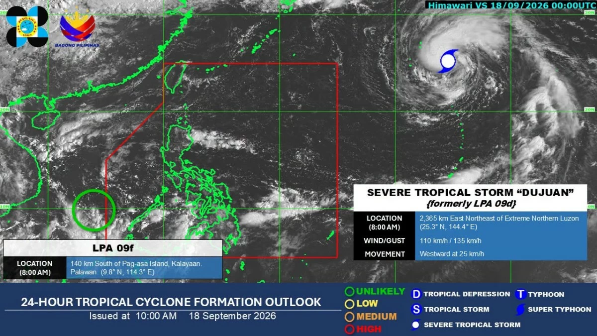
PAGASA weather specialist Leanne Loreto on Friday, Sept. 18, said the LPA may dissipate within the next 24 hours once it reaches the West Philippine Sea.
As of 8 a.m. Friday, LPA 09f was located 140 kilometers south of Pag-asa Island in Kalayaan, Palawan.
As the LPA is expected to dissipate, the southwest monsoon will likely prevail over the western sections of Southern Luzon, Visayas, and Mindanao from Saturday to Tuesday, Sept. 22.
In its weekly weather outlook, PAGASA said scattered rains and thunderstorms may affect Western Visayas, Negros Island Region, Zamboanga Peninsula, Palawan, and Occidental Mindoro until Tuesday.
The rest of the country may have partly cloudy to cloudy skies with isolated rain showers or thunderstorms.
PAGASA said the habagat may weaken again starting Wednesday, Sept. 23.
From Wednesday to Friday, Sept. 25, partly cloudy to cloudy skies are expected across the country, although isolated rain showers or thunderstorms may still occur, particularly in the afternoon and evening.
Meanwhile, Severe Tropical Storm Dujuan was located 2,365 kilometers east-northeast of extreme Northern Luzon as of 8 a.m. Friday.
Dujuan, which is moving westward at 25 kilometers per hour, is no longer expected to enter the Philippine Area of Responsibility or affect any part of the country, Loreto said.

No comments:
Post a Comment